MAIN PURPOSE:
Using GIS technologies and other modern software at all stages of geological exploration, During consists in conducting systematic research on the allocation of promising areas for mineral deposits, preliminary identification and monitoring of landslides, and the application of Remote Sensing (RS) methods to solve the scientific and practical problems of geology associated with the effective planning of field geological surveys.
BASIC TOOLS:
Data acquisition of Remote Sensing, and archiving and processing them;
Methodological improvement and development in the field of processing Satellite images in solving geological issues and applying visual decoding of the results obtained;
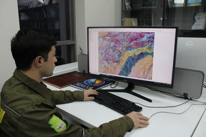
Development of GIS projects based on RS data, creation of a geospatial information system specially introduced through defined, positional global systems (Satellite navigators) of land surveys;
Implementation of scientific research work (SRW) within the framework of Satellite and Geoinformation information and technologies;
Monitoring of exogenous geological processes, monitoring of the state of the soil cover, soil erosion processes, monitoring of open water bodies by satellite images;
Drawing up cosmogeological distance basis maps on a regional (1:200000), medium (1:50000) and Local (1:25000-10000) scale;
Details of the study of the structural plan of Regions, ore fie, s and deposits;
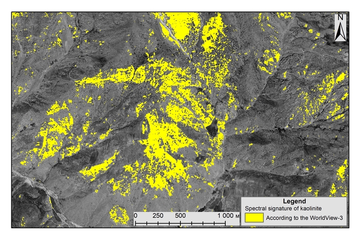
Identification of promising areas by summarizing the data of deposits covered with platform coatings, including complex geological, geophysical, cal, and geochemical studies, along with the results of Satellite images
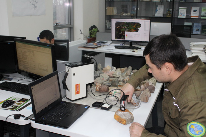
Conducting Spectro-radiometric studies in the field;
Crossing mountain-working (ditch, clearing) in promising areas wipridethe mary prediction of minerals based on geological editing of RS and GIS-technologies data, their sampling and documentation, as well as recultivation;
Evaluation of feasibility and mining economic consulting for the implementation of geological exploration work on minerals, feasibility study, and calculation of reserves;
To carry out forecasting of primary halo in regions where useful minerals are distributed using GIT technologies and other modern software supplies;
To visually and automatically find cracks in the earth with a high probability of mining around them as a result of processing into Satellite images, and to increase the economic economy in geological exploration as a result of the data obtained;
Conducting experiments to develop science and science in geology;
MAIN RESULTS:
Prepares High (2 meters) resolution panchromatic and medium (15 meters) resolution multispectral space images of the research area;
Digital terrain of the research area 3D-model is compiled (image accuracy 10 meters);
The tectonic characteristics of the research area are studied and modeled.
The boundaries of geological formations are separated based on photons;
Vertical and horizontal displacements over ground cracks are determined and analyzed;
Geoecologically monitored and monitored exogenous geological processes;
Based on the measurement data of the Geophysical instrument of magnetotelluric sensing, geology-Geophysical shearing of deep horizons is compiled;
Prediction maps for complex minerals are compiled;
A map of the distribution of minerals and minerals on Earth is drawn up;
Digital tectonic, geological, and geomorphological maps are compiled;
Migration of soils, salts, and minerals in the Earth's surface is determined and analyzed;
Promising structures are allocated and classified into hydrocarbon;
Studied and modeled based on the method of "interferometric analysis" of horizontal and vertical deformations of the Earth's surface based on tectonic forces;
A GIS-project is created that concentrates digital geological data;
National spectral libraries are created and mountain rocks and minerals are mapped through them:
Scientifically based guidelines are developed for the correct orientation of field geology-exploration work.