THE MAIN TASKS OF THE DEPARTMENT
- Constant filling and improvement of the developed information and reference system on geological, geophysical, geochemical and thematic study of the territory of the Republic of Uzbekistan by stages of geological exploration;
- creation of local databases, data on analytical work;
- development and improvement of methods and technologies for processing geological information
- modeling of ore deposits with the use of mining geological information systems;
- geostatistical studies of the distribution characteristics of useful components;
- geological and economic consulting, technical and economic assessment of MR deposits using GIS, preparation of feasibility studies, calculation of reserves;
- information support of mining enterprises;
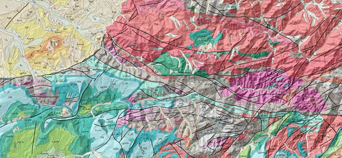
- creation of digital (electronic) geological maps of various contents in GIS format;
- support of the official website of the institute.

SCIENTIFIC RESEARCH CONDUCTED IN THE DEPARTMENT
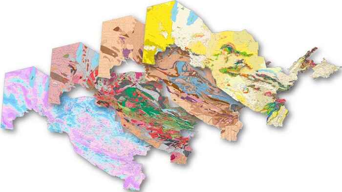
Within the framework of the project “Creation of a digital geological map of the territory of the Republic of Uzbekistan in GIS format on a scale of 1:200,000 for the study of natural conditions and rational use of the subsoil", the following works are carried out:
- creation of a database of the digital geological basis of the territory of Uzbekistan on a scale of 1:200,000 based on GIS technologies
- preparation of a geological map of the foundation before the Mesozoic in order to identify hidden ore formation
- preparation of a geophysical map for the search and exploration of deposits of solid minerals of a new type
- development of regulatory documents regulating the compilation of modern digital geological maps and a classifier that provides them in electronic form.
RESULTS OF SCIENTIFIC RESEARCH
- the geological basis of the territory of the Republic of Uzbekistan is divided into 20 regions;
- 20 regions were digitized in the ArcGIS program in a separate form;
- digitization of magnetic field anomalies on the geophysical study of the territory of the Republic of Uzbekistan;
- currently, the department is forming systems of conventional signs and codes to create an electronic classifier representing modern digital geological maps in an interactive form.